
History · Made by ice
The hills under these trails were left by a glacier.
Every climb, dip and hollow on the Meadowlark, Veterans and Knolls trails comes from the last Ice Age. Here's how the ground formed, and what lived on it before people arrived.
Deep time
From rivers to ice to forest.


The age of dinosaurs
Rivers spread sand and clay over what would become Long Island, roughly 100 to 90 million years ago. Those Cretaceous layers still lie under the island, on top of bedrock that sits nearly 2,000 feet down on the South Shore.
The ice arrives
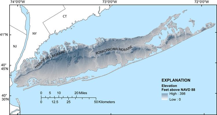
The Laurentide ice sheet pushes south from Canada and New England and stalls across the middle of Long Island, roughly 25,000 to 20,000 years ago. The rock and soil it bulldozes pile up as the Ronkonkoma moraine.
The North Shore hills form
As the ice pulls back, it pauses along the North Shore and builds a second ridge, the Harbor Hill moraine, roughly 21,000 to 18,000 years ago. That's the ground under our trails. Long Island's moraine hills top out around 400 feet, and its glacial deposits are up to 600 feet thick in places.
A lake becomes the Sound
Meltwater trapped behind the moraine forms Glacial Lake Connecticut. It drains roughly 18,000 to 15,000 years ago, and as the ice melts and sea level climbs from about 300 feet lower than today, salt water slowly fills the basin to make Long Island Sound.
Mastodons and mammoths
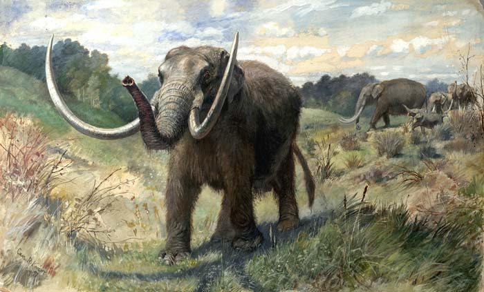
With the ice gone and the sea still low, Long Island is part of a wide coastal plain. Fishermen have pulled mammoth and mastodon teeth from at least 40 spots on the continental shelf offshore, and a mastodon was dug up in 1858 at Baisley Pond in what is now Queens. Across New York, about 150 mastodon finds date to roughly 15,000 to 12,000 years ago.
The first people
People are on Long Island by roughly 12,000 to 13,000 years ago. Their Clovis spear points have been found here. Their story continues with the Matinecock.
Marshes and forests settle in
By about 5,000 years ago, salt marshes are growing on the North Shore's glacial deltas.
Read the ground as you ride
Kames are mounds of sand and gravel that piled up in gaps and holes in the melting ice. Kettles are bowl-shaped hollows left where buried blocks of ice melted out. The Town's Crab Meadow watershed plan names Meadowlark, Knolls and the Veterans Nature Study Area as some of the best places in the area to see this kame-and-kettle terrain. The ups and downs that make these trails fun are a glacier's leftovers.
The ice also dropped boulders, called erratics, carried south by the ice. The best known on Long Island is Shelter Rock in Manhasset, about 55 feet tall and roughly 1,800 tons.
A fossil find just up the road
No dinosaur bones have ever been found on Long Island. But in 2023, geologists from Hofstra University reported the first animal fossils ever found in the island's Cretaceous layers: a bone fragment and a small fish vertebra from the bluffs at Makamah Beach, near Geissler's Beach in Fort Salonga. The researchers say dinosaur remains should exist in these same layers. Fossil leaves of sassafras and willow also wash out of North Shore bluffs.
Look, don't dig. The bluffs are fragile. If you think you've found a fossil, photograph it where it lies and note the spot.
Sources: USGS, Long Island topography · USGS Ground Water Atlas · USGS, Long Island Sound geology · Long Island Sound Study · Crab Meadow Watershed Plan (final draft) · Hart & Bennington, 2023 · Whitmore et al., Science, 1967 · Horenstein, 2008 · NY State Museum · TBR News Media · Shelter Rock